Object data in, location report out
A floor plan PDF, an OpenImmo export or an IFC model goes in. Out comes a report on the light in these rooms and on what lies outside the door — measured from open data, not written from a sales text.
An exposé describes the flat. What it almost never describes is what the flat cannot change: which room gets sun in December, how loud the street is at night, how the summer heat behaves in this block, whether the roof would carry a solar array. Those questions decide whether someone still likes the flat in the second winter — and they are answerable from open data, for any address in Vienna.
Open the light check →Three ways in
Whichever way the data arrives, one reader stands behind all three — so the screen and the exported PDF can never disagree. What a file does not contain stays empty and is named as missing; nothing is filled in with a plausible guess.
And out comes a document you can hand over
A vector PDF, not a screenshot: text stays text, the font is embedded, every device shows the same thing, and instead of a print dialogue you get a download. Page numbers, the source under every figure, and the sender in the running header. Pages can be switched off before the export — light, rooms, flight path, surroundings, location.
One rule holds for all of it, and it is worth saying out loud: a measured disadvantage is never removed. Flight paths, shading and summer heat stay in the report and get explained better — they cannot be switched off on request. A report that whoever pays for it can retune is not worth reading.
Frequently asked
Does the file leave my computer?
No. PDF, XML and IFC are read in the browser — there is no upload and no endpoint they could be sent to. The address itself is only ever passed to third-party services in rounded form (building heights, tree register, roof cadastre), never in full.
What exactly is in the report?
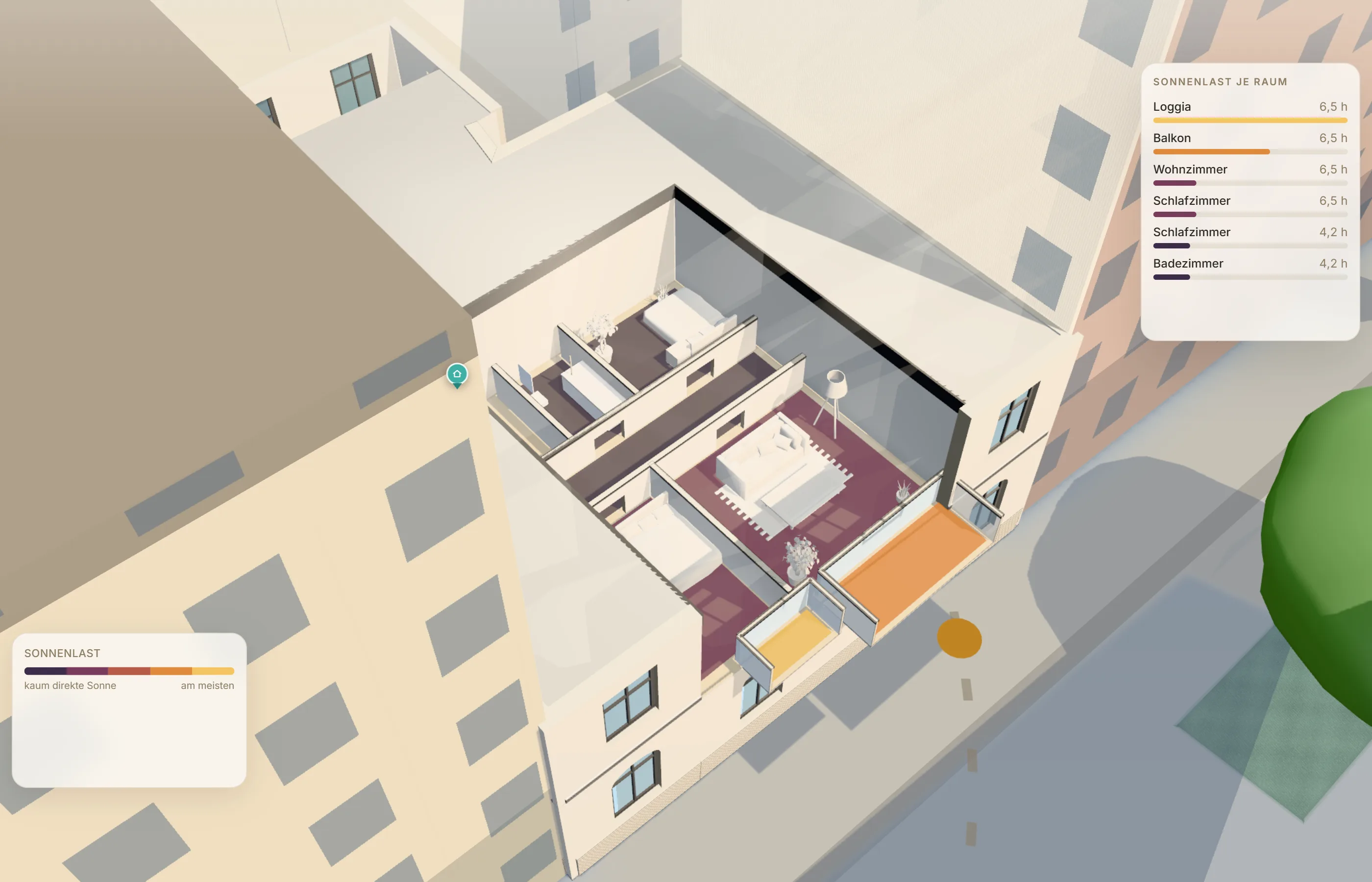
Hours of direct sun per room on the summer and winter reference days, a sun-load map of the flat, plant light per room, the flight-path situation, and the surroundings: modelled summer heat, road noise from the official 2022 mapping, street trees, markets, water — plus the roof solar potential from the City of Vienna cadastre. Every figure carries its source and its limit.
Is this a certificate of insolation?
No, and it never claims to be. It is a model built from window direction, measured neighbouring heights (or, where those are thin, the legal building class) and the real path of the sun. Curtains, balconies and a bright wall opposite are not part of the calculation. A certificate under ÖNORM is a different, signed document.
Can I put my own name on it?
Yes. The sender slot belongs to whoever passes the report on: name and contact stay in your browser and appear on the pages. Our own name is not on the cover — the document belongs to the sender.
What does it cost to try?
Nothing to look. Open the light check, drop a plan in, and read the result on screen before exporting anything.
Sources: City of Vienna Open Data (generalised roof model LOD2.1, zoning, tree register, solar cadastre, CC BY 4.0) · OpenStreetMap contributors (ODbL) · environmental noise mapping 2022 (CNOSSOS-EU), laerminfo.at · sun position calculated astronomically. Orientation values, not a legal document.