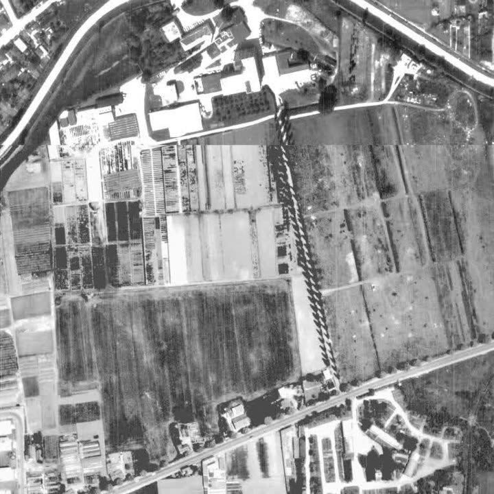
Your address from above, 1938 to today: twenty aerial surveys of the City on one slider
What lay under your flat 70 years ago? The City of Vienna has photographed its area from the air again and again. Azima stacks those images at one address: the same spot, one slider, from 1938 to 2025.
The address goes to the City of Vienna address service for the search, never to Vienna Living Map. Aerial survey plans and orthophotos: City of Vienna, data.gv.at, CC BY 4.0. The same address in Azima: sun, noise, registers ›
Eight of the images are black-and-white aerial survey plans from 1938 to 1992, twelve are colour orthophotos from 2014 to 2025. The picture shows the block and the streets beside it, the address in the middle. Where Seestadt stands today, the runway of Aspern airfield lies in 1956; where the Alt-Erlaa housing estate stands, there are still fields and market gardens in 1971.
Compute it for your address — free, no account:
The address goes to the City of Vienna address service for the search, never to Vienna Living Map. The result stays on this device. No account.
What is computed — and where it stops
The images show; they do not judge. Under every year it says when it was flown: in March the trees carry no leaves, in June they do — a bare spring is not vanished greenery. And between 1992 and 2014 the slider jumps 22 years, because the series the City keeps as tiles contains no survey in between.
Frequently asked
Where do the aerial images come from?
From the City of Vienna: survey plans and orthophotos from its tile service, one dataset per year on data.gv.at, licence CC BY 4.0. Azima loads them through its own domain; only the number of a tile goes to the City, never the address.
Why are the years between 1992 and 2014 missing?
In the series the City keeps as tiles, 1992 is followed by 2014. What lies in between is not shown — the slider jumps instead of filling a gap.
Can I see what used to stand on the plot?
You see the spot from above, as sharp as the survey was at the time. For the earlier use of a plot that is a clue, not proof; the official registers for the address sit in the same chapter above it.
Does it cost anything?
No. The time travel is there at every address in Vienna, in the “Property” chapter, without an account.
All measurements · For agents & developers · The light check
Aerial survey plans 1938–1992 and orthophotos 2014–2025 of the City of Vienna (data.gv.at, CC BY 4.0), loaded through the site’s own domain. No image comparison by software, no interpretation; the season of each survey is stated with every year.