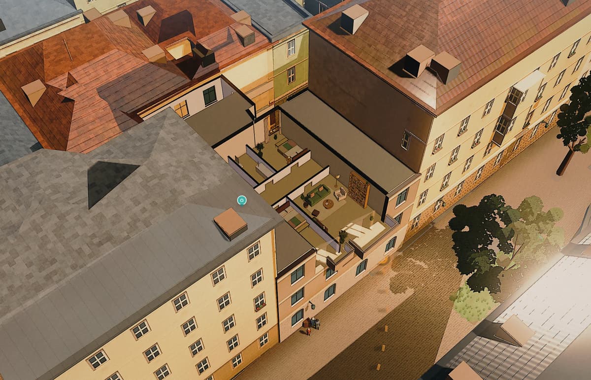
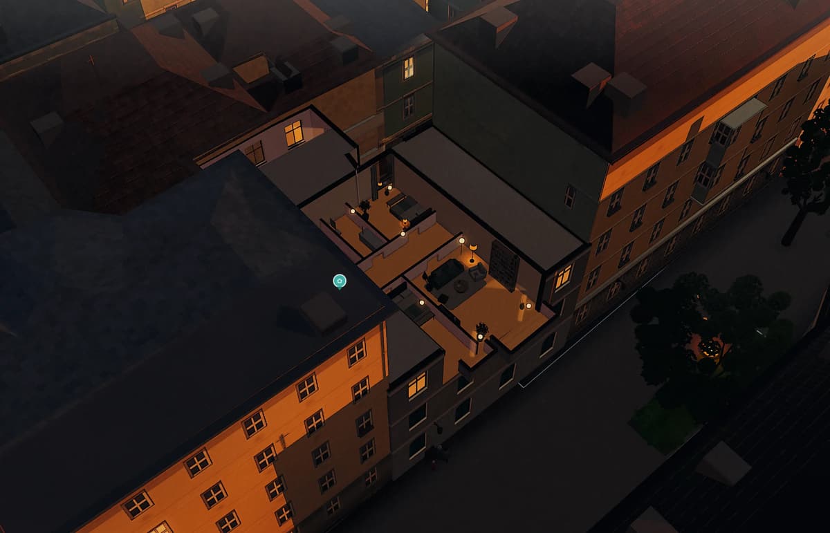
 21 June · 15:0021 December · 15:00
A flat in Vienna-Neubau · second floor
Viewed in June. Lived in December.
On 21 December the sun rises over Vienna at 7:43 and sets at 16:03: 8 h 20 min of daylight. At noon it stands 18.4° high — on 21 June it is 65.2°. What that means for a real flat is shown below, quarter hour by quarter hour, from the Azima stage: the house at Schrankgasse 10 with its measured neighbours.
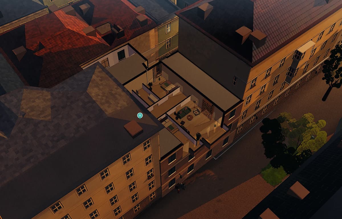
- 7:43 · Sunrise.The bedroom won’t see it until 9:10.
- 20 minutes of sun in the bedroom.9:10 to 9:30, through the courtyard window. That is all this room gets today.
- 11:35 · Now the living room.Street side, facing west: 3 h 5 min of sun, until 14:40.
- Noon. It climbs no higher than 18.4°.On 21 June, at the same hour, it stands at 65.2°.
- The living room keeps it until 14:40.The same flat, the same day — one room has three hours, the other twenty minutes.
- 15:00 — the same minute as in June above.This time the sun stands 7.0° above the horizon.
- 16:03 · Sunset.8 h 20 min of daylight. In June it is 16 h 4 min.
- 17:30 · Night.In June it would stay light for another 3 h 29 min.
Why Vienna is like this
8 h 20 min of light.
In June it is almost twice as long, and at noon the sun stands more than three times as high.
Astronomical sun path for Vienna, 48.2° N
Vienna sits where the Alps end.
The Vienna Woods to the west, the plain to the east, the Danube in between — and far enough north that the winter sun stays low.
Heights: Hermannskogel, the highest point of Vienna, and St Stephen’s Square
It climbs no higher than 18.4°.
On 21 June, at the same hour, it is 65.2°.
Block after block. Courtyards in between.
The Gründerzeit built Vienna densely. A 21-metre building casts a 63-metre shadow at noon in December — four lane widths.
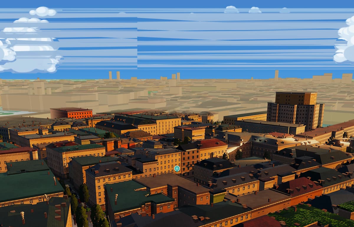
Image: Azima stage, Schrankgasse 10, 21 December 13:00 — calculated, not photographed
Sun above. Shade below.
The building opposite draws the line. Whoever lives above it has winter sun.
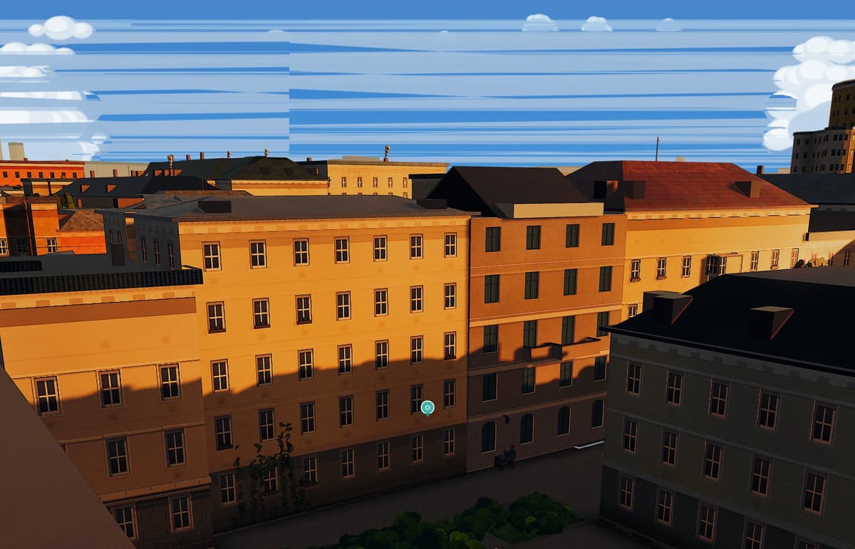
Image: Azima stage, 21 December 14:00
What only Azima shows
The sun in the room.
Sun maps stop at the facade. Azima keeps going: through the window, down to the floor, room by room.
Light report of the example flat Schrankgasse 10, 2nd floor: direct sun per room on 21 December, against the measured neighbouring buildings
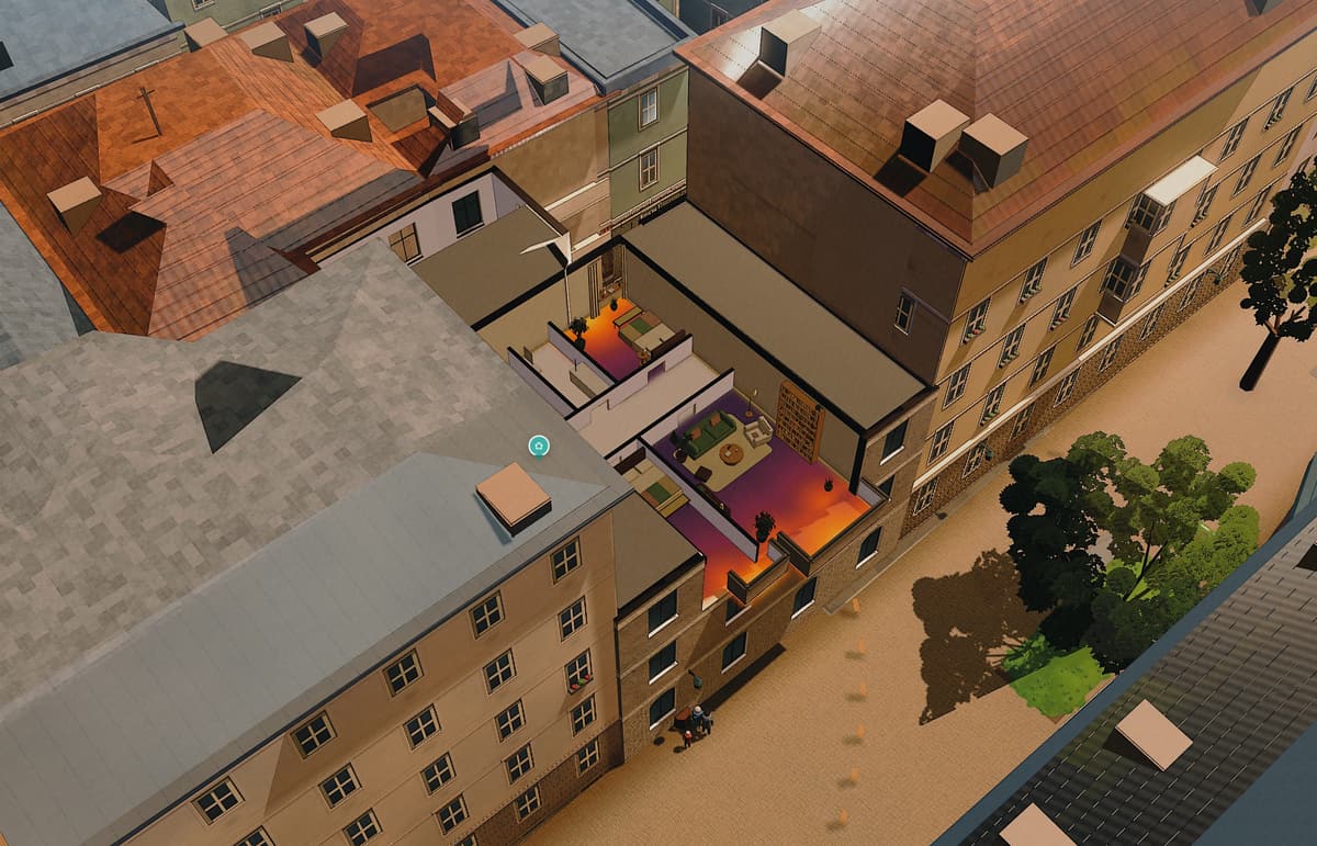
Sun load map of the flat, 21 June 13:05 — calculated in the browser, no upload, verifiable in the network tab
And in your Grätzl?
From 0.2 to 8 hours.
That is how long the sun shines on the street on 21 December — depending on the Grätzl.
Street level at the centre of each Grätzl, against the surrounding buildings (OpenStreetMap) and the terrain
How it is calculated
105,120 sun positions.
Every five minutes, for a whole year — against the roof model, the trees and the streets of the City of Vienna.

220 × 220 m around Schrankgasse 10, every layer drawn from its file · data.wien.gv.at, CC BY 4.0
Calculated on your device.
Azima builds the house and its neighbours from the roof model as a 3D world in the browser and runs the sun over it — on the graphics card of your phone or laptop, without a server. The address goes to OpenStreetMap only for the neighbouring buildings; the floor plan never leaves the device.
And in summer?
Then light turns into heat.
Where Vienna is densely built, heat builds up into the night. Azima shows which room warms up in the afternoon.
Summer heat index per district (0–100), modelled from built form, green, street trees, water and elevation — not a measured temperature
Luckily, there is wind.
The west wind comes over the Vienna Woods. And on still summer nights cool air flows from the forest into the city — as far as Hietzing, Penzing, Ottakring and Hernals.
Mean wind in km/h at four stations (GeoSphere Austria) · night air: urban climate analysis of the City of Vienna 2020
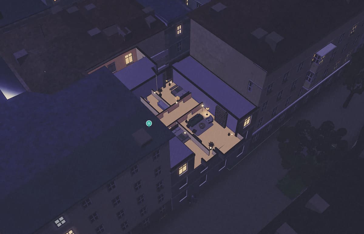
Which room wins at yours in winter?
Enter the address and floor, add the floor plan — and you see it per room, for 21 December as well as 21 June.
Check the light →It calculates a clear sky. Against high fog, even the fourth floor does not help.
Sources Sun positions: astronomical (SunCalc) for 48.2° N, 21 June and 21 December 2026, Vienna time. Buildings: roof model LOD2.1 of the City of Vienna; trees: tree register; paving: road surface data (data.wien.gv.at, CC BY 4.0); OpenStreetMap. Rooms: light report of the example flat Schrankgasse 10, 2nd floor. Grätzl: street-level sun at each Grätzl centre against the surrounding buildings (OpenStreetMap) and the terrain. Heat: modelled index from built form, green, street trees, water and elevation — not a measured temperature. Wind: station means, GeoSphere Austria; night air: urban climate analysis of the City of Vienna 2020 (MA 18). One calculation, not an expert report.